| CPC G06T 3/4038 (2013.01) [G06T 5/50 (2013.01); G06T 7/11 (2017.01); G06T 7/174 (2017.01); B64U 10/20 (2023.01); B64U 2101/32 (2023.01); B64U 2101/40 (2023.01); B64U 2201/10 (2023.01); G06T 2207/10032 (2013.01); G06T 2207/20221 (2013.01)] | 20 Claims |

|
1. A method comprising:
receiving a plurality of images of a geographic area, wherein a portion of each received image is within the geographic area, and wherein at least two of the received plurality of images overlap within the geographic area;
determining a set of images from the received plurality of images for further processing by selecting at least one image of the plurality of images capturing an overlapping geographic area to be used;
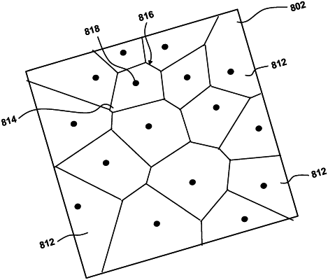
determining a plurality of image points, wherein each image point is a geographic location of a center field of view of each image of the determined set of images;
partitioning the geographic area into a plurality of image regions based on the determined plurality of image points; and
generating a combined image by stitching the partitioned geographic area of the determined set of images into the combined image.
|