| CPC G06T 17/05 (2013.01) [G01C 21/3626 (2013.01); G01C 21/367 (2013.01); G01C 21/3676 (2013.01); G01C 21/3694 (2013.01); G06Q 10/047 (2013.01); G06T 17/20 (2013.01); G08G 1/0962 (2013.01); G08G 1/0967 (2013.01); G08G 1/096716 (2013.01); G08G 1/096741 (2013.01); G08G 1/096775 (2013.01); G08G 1/096816 (2013.01); G08G 1/096827 (2013.01); G08G 1/096861 (2013.01); H05K 999/99 (2013.01); G06T 2200/24 (2013.01)] | 20 Claims |
|
1. A method comprising:
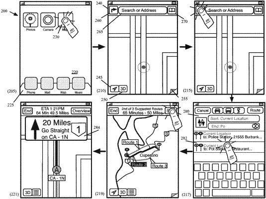
rendering a first perspective view of a three-dimensional (3D) map scene in which roads, structures, and road condition representations are displayed as graphical objects within the 3D map scene, wherein a first road condition representation is displayed adjacent and/or above a corresponding road section;
presenting, on a display device, the first perspective view of the 3D map scene, wherein the first road condition representation is not occluded by any of the structures;
receiving user input on the first perspective view of the 3D map scene to adjust a perspective presented by the first 3D map presentation; and
in response to receiving the user input, presenting, on the display device, a second perspective view of the 3D map scene in accordance with the user input, wherein at least a first structure occludes at least a portion of the first road condition representation.
|