| CPC B61L 27/16 (2022.01) [B61L 25/02 (2013.01); B61L 27/30 (2022.01); B61L 27/40 (2022.01); B61L 27/70 (2022.01); G01C 21/005 (2013.01); G06F 16/2365 (2019.01); H04L 43/103 (2013.01); H04L 67/12 (2013.01)] | 21 Claims |
|
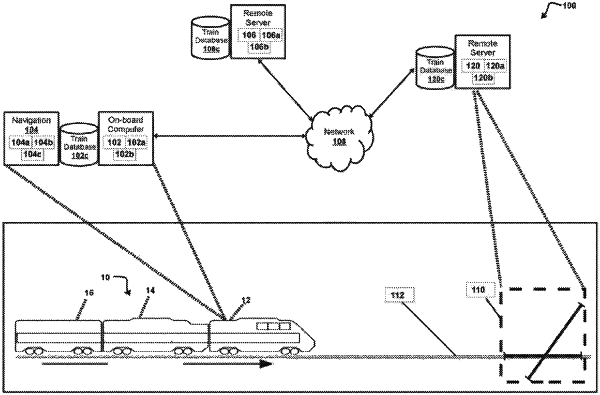
1. A computing system comprising:
one or more processors configured to:
obtain data associated with one or more operating authorities operating one or more areas through which a vehicle may travel;
send an ancillary area version request message to a remote server to determine an ancillary area that is not included in the data;
receive additional data from a first operating authority of the one or more operating authorities that is associated with the ancillary area that is not included in the data;
communicate with one or more wayside interface units in the ancillary area that is not included in the data; and
establish an unique secure communication channel with the one or more wayside interface units responsive to determining the ancillary area that is not included in the data.
|