| CPC G06Q 40/08 (2013.01) [G06F 16/29 (2019.01); G06N 20/00 (2019.01); G06T 7/0002 (2013.01); G06V 20/176 (2022.01); G06T 2200/24 (2013.01); G06T 2207/10032 (2013.01); G06T 2207/20081 (2013.01); G06T 2207/20104 (2013.01); G06T 2207/30184 (2013.01)] | 19 Claims |

|
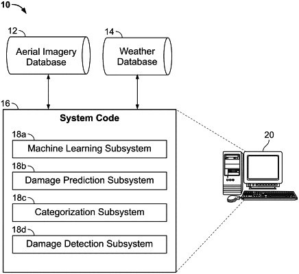
1. A method for predicting damage to a structure, comprising:
receiving at a computer system an indication of a geospatial region of interest from a user;
retrieving by the computer system one or more aerial images associated with the region of interest from an aerial image database;
processing the one or more aerial images using a machine learning algorithm executed by the computer system to extract one or more attributes of a structure within the region of interest;
retrieving by the computer system weather data associated with the region of interest from a weather database;
determining by the computer system a likelihood of damage to the structure based on the one or more extracted attributes and the weather data associated with the region of interest; and
transmitting a data package from the computer system which includes the likelihood of damage to the structure; and
displaying said data package in a graphical user interface, said graphical user interface displaying said geospatial region of interest in a project map, said project map displaying a property corresponding to the structure as a point within the geospatial region of interest, said point selectable by a user of the graphical user interface to cause a property information window to be displayed in said graphical user interface in response to selection of the point by the user, said property information window including information about the property and a weather event corresponding to the property,
wherein said project map includes a plurality of user-selectable display layers selectable by toggling each of said user-selectable display layers on or off, wherein at least one of the plurality of user-selectable display layers includes a graphical depiction of the weather event overlaid on the property.
|