| CPC G01C 21/3811 (2020.08) [B60W 60/001 (2020.02); G01C 21/3815 (2020.08); B60W 2420/42 (2013.01); B60W 2420/52 (2013.01); B60W 2556/50 (2020.02)] | 10 Claims |

|
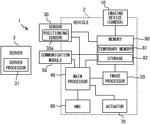
1. A method for generating or updating map data that includes coordinate information of a plurality of landmarks disposed along a road, the method executed in collaboration with a vehicle-side device in a vehicle and a server that manages the map data, the method comprising:
by the vehicle-side device, determining whether to update the map data in association with a road segment on which the vehicle is traveling by:
acquiring, from a peripheral monitoring sensor mounted on the vehicle, peripheral object data representing a feature disposed in a vicinity of the vehicle;
analyzing the peripheral object data to calculate a position of a landmark with respect to the vehicle;
calculating a first position of the vehicle based on (i) the position of the landmark with respect to the vehicle calculated from the peripheral object data and (ii) a position of the landmark in the map data;
calculating a second position of the vehicle based on information that does not include the map data;
comparing the first position and the second position to determine whether the first position and the second position deviate from each other; and
transmitting index information to the server indicating that a position misalignment occurs in the map at the second position for a state in which the first position and the second position deviate from each other, the index information comprising a request to the server requesting that the map data be updated;
by the server, setting an update flag indicating that the map data needs to be updated for the road segment based on the index information transmitted from the vehicle-side device, the update flag being set for a point where the position misalignment occurs a predetermined number of times or a predetermined frequency; and
by the vehicle-side device, downloading updated map data from the server and performing a control of the vehicle.
|