| CPC G08G 5/0069 (2013.01) [G06V 20/39 (2022.01); G08G 5/0013 (2013.01); G08G 5/0026 (2013.01); G08G 5/003 (2013.01); G08G 5/0034 (2013.01); G08G 5/006 (2013.01); G08G 5/0086 (2013.01); B64U 10/13 (2023.01); B64U 2101/30 (2023.01); B64U 2201/104 (2023.01)] | 30 Claims |
|
1. A method, comprising:
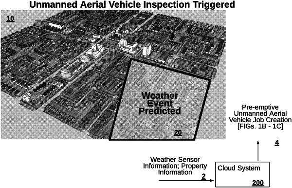
identifying a property for inspection based on a weather event impacting the property;
determining a flight plan usable by an unmanned aerial vehicle (UAV) in identifying an extent of damage to the property caused by the weather event;
presenting, at a user device, a user interface comprising user interface controls configured for toggling layers of the user interface, the layers comprising a first layer that includes a geofence, a second layer that includes an inspection area of the property, a third layer that includes at least one of a launch location or a landing location of the UAV, and a fourth layer that includes a base map layer of an area that includes the property; and
receiving, via the user interface, a modification to the flight plan,
wherein the modification includes an instruction to obtain sensor data related to another property adjacent to the property by pointing a sensor of the UAV towards the other property.
|