| CPC G01S 19/47 (2013.01) [G01S 19/28 (2013.01); G01S 19/33 (2013.01); G01S 19/396 (2019.08); G01S 19/41 (2013.01); G01S 19/43 (2013.01)] | 21 Claims |

|
1. A method for determining a positioning solution of a rover comprising:
receiving a set of satellite signals associated with one or more satellite constellations;
selecting a first subset of satellite signals from the set of satellite signals;
determining a satellite position, velocity, and acceleration (PVA) for each satellite associated with a satellite signal in the first subset of satellite signals;
determining a variance model based on the satellite PVA;
selecting a reference satellite from the satellites associated with a satellite signal in the first subset of satellite signals;
applying an a-priori correction to each of the satellite signals in the filtered first subset of satellite signals;
determining a set of differenced satellite signals between a satellite signal associated with the reference satellite and each of the satellite signals associated with the remaining satellites;
determining a set of time differenced satellite signals between the differenced satellite signals from a current epoch and a previous epoch; and
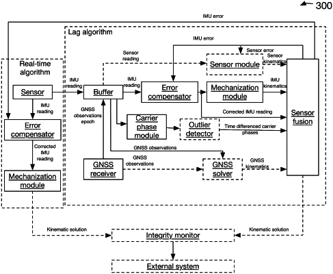
determining the positioning solution of the rover using a fusion engine comprising an estimator that processes the set of time differenced satellite signals, inertial measurement unit (IMU) data, and the variance model, wherein the estimator uses stochastic cloning to model displacements using the set of time differenced satellite signals.
|