| CPC G01C 21/32 (2013.01) [G06F 16/23 (2019.01); G06F 16/29 (2019.01)] | 20 Claims |

|
1. A method of validating a digital map comprising:
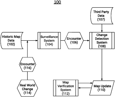
determining, by one or more processors and using a decay model, an accuracy estimate for each of one or more features associated with one or more geographic regions of the digital map, wherein the accuracy estimate for each of the one or more features that is determined by the decay model decreases as a time period between measurements of the one or more features increases;
receiving, by the one or more processors, change data indicating a discrepancy in a subset of the one or more features of the one or more geographic regions, wherein the change data comprises aggregated feature discrepancies received by a change detection database from one or more sources;
updating a change rate with respect to the aggregated feature discrepancies in the subset of the one or more features;
determining, by the one or more processors, a surveillance cadence based on an updated change rate and the accuracy estimate determined by the decay model, wherein the surveillance cadence indicates an accuracy of changes associated with the one or more features; and
based on the surveillance cadence, triggering, by the one or more processors, generation of a surveillance task that causes a vehicle to navigate to the one or more geographic regions for data collection.
|