| CPC G08G 1/0965 (2013.01) [G08G 1/207 (2013.01); H04W 4/022 (2013.01); H04W 4/90 (2018.02)] | 16 Claims |

|
1. A system for providing an emergency vehicle (EV) alert, comprising:
a first computing system configured to:
receive EV data from the EV;
receive a geographical map data from a storage device;
define at least one zone on a map rendered using the geographical map data;
determine a zone, among the at least one zone, to which a current location of the EV belongs;
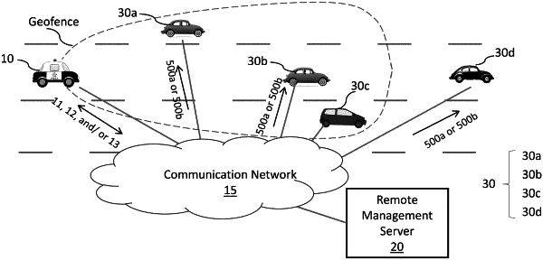
determine a geofence for the EV at least based on the EV data and the determined zone on the map;
transmit the determined geofence to a second computing system associated with another vehicle; and
wherein when the road has a median strip, in a first zone with the median strip, the determined geofence is defined to exclude one or more opposite lanes over the median strip, and in a second zone without the median strip, the determined geofence is defined to include the opposite lanes.
|