| CPC G06V 20/584 (2022.01) [G06F 18/253 (2023.01); G06N 20/00 (2019.01); G06T 7/529 (2017.01); G06V 20/58 (2022.01); G06V 20/588 (2022.01); G06V 2201/07 (2022.01)] | 8 Claims |

|
1. A method for evaluating sensor data on a road, the method comprising:
ascertaining sensor data by scanning a surrounding area, using at least one sensor;
based on the sensor data, carrying out object detection for determining objects from the sensor data;
carrying out object filtering; and
identifying surface characteristics of at least one object, and/or the surface characteristics of the at least one object are ascertained by using access to a database;
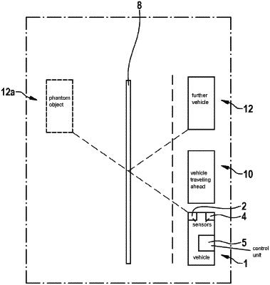
wherein the road has lanes which are set apart from one another by a roadway divider having specular characteristics, and
wherein at least one phantom object in the sensor data is removed or a position thereof is corrected based on the ascertained surface characteristics of the at least one object by triangulation.
|