| CPC G06T 17/05 (2013.01) [B64C 39/024 (2013.01); G01S 17/89 (2013.01); G06F 16/29 (2019.01); G06N 3/049 (2013.01); G06N 3/08 (2013.01); B64U 2101/30 (2023.01)] | 19 Claims |

|
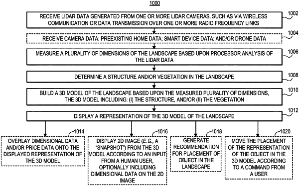
1. A computer-implemented method for visualization of landscape design, the method comprising, via one or more processors, sensors, servers, and/or transceivers:
receiving light detection and ranging (LIDAR) data generated from a LIDAR camera;
measuring a plurality of dimensions of a landscape based upon processor analysis of the LIDAR data;
building a 3D model of the landscape based upon the measured plurality of dimensions, the 3D model including: (i) a structure, and (ii) a vegetation;
displaying a representation of the 3D model;
receiving object data from a user, wherein the object comprises one of: a patio; a shed; a garage; a fence; a tree; a flower; or a pathway; and
inputting, into a machine learning algorithm: (i) data of the 3D model of the landscape, and (ii) the received object data to generate a recommendation for placement of the object in the landscape;
wherein the machine learning algorithm is trained based upon preexisting data of object placement in landscapes.
|