| CPC G06T 9/40 (2013.01) | 13 Claims |
|
1. A method comprising:
receiving, by a computer system, encoded data regarding a plurality of points in a three-dimensional point cloud, wherein the encoded data comprises:
a prediction tree having a plurality of nodes generated based on spatial information regarding the plurality of points and one or more properties of a sensor system that obtained the spatial information,
wherein the sensor system comprises one or more light detection and ranging (LIDAR) sensors, and wherein the one or more properties of the sensor system comprise at least one of:
a rotational speed of one or more light emitters in the one or more LIDAR sensors,
a physical arrangement of one or more light emitters in the one or more LIDAR sensors, or
a pattern of emission of one or more light emitters in the one or more LIDAR sensors,
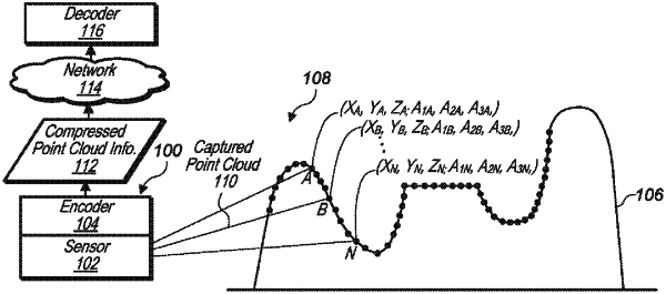
wherein a value of each node in the prediction tree represents first spatial coordinates of a respective one of the plurality of points according to a first coordinate system, and
wherein the value of at least a first node in the prediction tree is determined by predicting a position of a first point associated with the first node based on a value of one or more ancestor nodes of the first node and the one or more properties of the sensor system;
decoding, by the computer system, the encoded data to determine first data regarding the plurality of points, wherein the first data comprises:
the first spatial coordinates of at least some of the points, and
one or more quantization parameters associated with the first spatial coordinates;
determining, by the computer system, second data regarding the plurality of points based on the first data, wherein the second data comprises second spatial coordinates of at least some of the points according to a second coordinate system different from the first coordinate system; and
generating, by the computer system, a representation of the three-dimensional point cloud based on the second data.
|