| CPC G01S 17/93 (2013.01) [G01S 7/483 (2013.01); G01S 7/4817 (2013.01); G01S 17/04 (2020.01); G01S 17/86 (2020.01); G01S 17/89 (2013.01)] | 15 Claims |

|
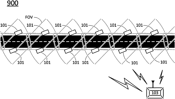
1. A LIDAR system, the LIDAR system comprising:
a plurality of anchored LIDAR sensing units, each anchored LIDAR sensing unit comprising at least:
a housing;
at least one detector, mounted in the housing, configured to detect light signals arriving from objects in a field of view of the anchored LIDAR sensing unit;
a communication unit, configured to output detection information which is based on outputs of the at least one detector and which is indicative of existence of the objects; and
at least one integratory processing unit, configured to receive the detection information from two or more of the plurality of anchored LIDAR sensing units, to process the received detection information to provide a three dimensional (3D) model of a scene which is larger than any of the field of views of the independent anchored LIDAR sensing units,
wherein the at least one integratory processing unit is configured to:
wirelessly transmit to a first vehicle, based on at least one of a type, a speed, or a location of the first vehicle, first 3D data pertaining to a spatial area at a first time; and
wirelessly transmit to a second vehicle, based on at least one of a type, a speed, or a location of the second vehicle, second 3D data pertaining to the spatial area at the first time, wherein the first 3D data and the second 3D data comprise 3D data indicative of portions of the 3D model in different levels of details.
|