| CPC G05D 1/0607 (2013.01) [G05D 1/042 (2013.01); G05D 1/101 (2013.01)] | 9 Claims |
|
1. A method for generating a trajectory to bring an aircraft in flight from a current position of the aircraft to a destination having a georeferenced position, the method being implemented by an automatic trajectory generation system formed as electronic circuitry embedded in the aircraft, the method comprising the following steps:
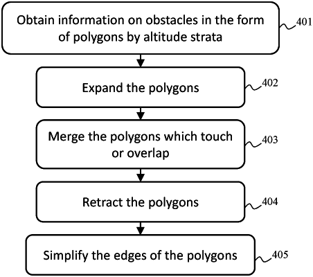
obtaining polygons representative of obstacles potentially encountered by the aircraft from the current position of the aircraft to the destination, each polygon being associated with an altitude layer in which the obstacle is included in the polygon;
defining two first circles that are tangential with respect to a current direction of flight of the aircraft, one being centered on right side, another being centered on a left side, with respect to a current position of the aircraft, a radius of the first circles being a minimum turn radius that the aircraft can perform given its operational state;
defining two second circles that are tangential with respect to a direction to be followed to the destination, one being centered on the right side, the other being centered on the left side, with respect to the georeferenced position of the destination;
defining a third circle around vertices of the polygons, of radius equal to a maximum between a predetermined lateral margin and a turn radius that the aircraft can perform in light of a speed of the aircraft on arrival at a vertex of the polygon;
searching for a flyable lateral trajectory between the current position of the aircraft and the destination by bypassing the polygons by the vertices, by searching for tangential trajectories between the circles, by observing a pre-established vertical trajectory profile, the current direction of flight of the aircraft and the direction to be followed to the destination, as well as the predetermined lateral margin and a predetermined vertical margin with the polygons, and
for at least one polygon edge, the method comprises the following steps:
calculating a distance between the current position of the aircraft and each polygon edge;
when the vertical trajectory profile corresponds to a climb, determining, as a function of the vertical trajectory profile, whether, after having travelled the distance to the edge minus the lateral margin, an altitude of the aircraft is greater than that of the edge plus the vertical margin, and if yes, excluding the edge from the search for a flyable lateral trajectory; or
when the vertical trajectory profile corresponds to a descent, determining, as a function of the vertical trajectory profile, whether, after having travelled the distance to the edge plus the lateral margin, the altitude of the aircraft is lower than that of an altitude layer below the edge plus the vertical margin, and if yes, excluding the edge from the search for a flyable lateral trajectory,
determining candidate trajectories by progression from circle to circle among said circles and storing the candidate trajectories in a list;
choosing from the list, a candidate trajectory to be continued which is most promising in light of a cost function F such that:
F=G+H
in which G is a distance travelled to a current end of the candidate trajectory and H is a path search heuristic which underestimates the distance still to be travelled to the destination, and
when the automatic trajectory generation system has found a first safe candidate trajectory to a polygon vertex, saving its distance value, denoted Gv;
when the automatic trajectory generation system finds a second candidate trajectory which envisages meeting the vertex to bypass it with a current distance value, denoted Gp, testing the following condition:
Gp+dmin>Gv
in which dmin is a lower limit of path length between a position at which the trajectory considered stops and the vertex;
when the condition is fulfilled, conserving the unchanged list, and otherwise, replacing the first candidate trajectory with the second candidate trajectory in the list.
|