US 12,190,609 B2
Method and system for map construction
Minhao Jiang, San Diego, CA (US); Hsin Lu, San Diego, CA (US); Genmao Shi, San Diego, CA (US); and Ziqi Liu, San Diego, CA (US)
Assigned to TUSIMPLE, INC., San Diego, CA (US)
Filed by TUSIMPLE, INC., San Diego, CA (US)
Filed on Jul. 27, 2023, as Appl. No. 18/360,556.
Application 18/360,556 is a continuation of application No. 17/405,397, filed on Aug. 18, 2021, granted, now 11,721,112.
Application 17/405,397 is a continuation of application No. 16/286,287, filed on Feb. 26, 2019, granted, now 11,170,230, issued on Nov. 9, 2021.
Prior Publication US 2023/0410536 A1, Dec. 21, 2023
Int. Cl. G06V 20/56 (2022.01); G01C 21/32 (2006.01); G01S 19/48 (2010.01); G06F 16/29 (2019.01); G06T 7/11 (2017.01); G06T 7/73 (2017.01); G08G 1/16 (2006.01)
CPC G06V 20/588 (2022.01) [G01C 21/32 (2013.01); G01S 19/48 (2013.01); G06F 16/29 (2019.01); G06T 7/11 (2017.01); G06T 7/75 (2017.01); G08G 1/167 (2013.01); G06T 2207/30256 (2013.01)] 20 Claims
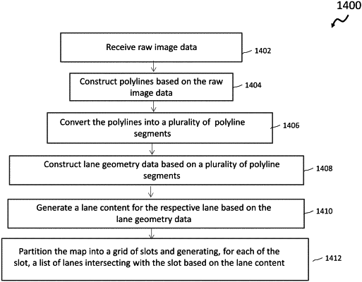
OG exemplary drawing
 
1. A method of map construction, comprising:
constructing an outline circumscribing a plurality of lanes on a road based on a plurality of segments that extend along the plurality of lanes or the road; and
identifying an individual outline of each of the plurality of lanes based on the plurality of segments and the outline circumscribing the plurality of lanes,
wherein the plurality of segments is obtained by partitioning polylines describing a shape of the road into segments that are constructed on a start point, an end point, or a turning point of the polylines.