| CPC G06T 11/00 (2013.01) [G06F 3/017 (2013.01); G06F 9/541 (2013.01); G06N 20/00 (2019.01); G06Q 20/10 (2013.01); G06F 3/013 (2013.01); G06F 3/04842 (2013.01); G06F 3/167 (2013.01); G06T 2200/24 (2013.01)] | 20 Claims |

|
1. A computer-implemented method comprising:
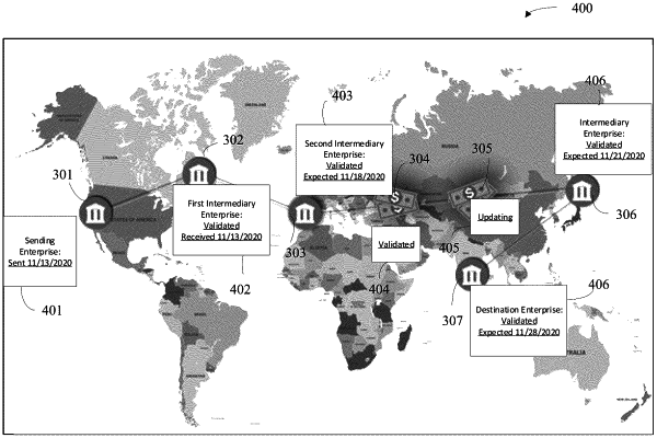
generating a first visualization layer comprising a set of geographic or physical indicators in a multi-nodal transfer route, the transfer route comprising a set of three or more nodes that include terminal nodes and at least one transitional node, wherein the geographic or physical indicators correspond to locations of computing systems that are along the transfer route and that implement transfers between nodes in the set of three or more nodes of the transfer route;
executing one or more application program interface (API) protocols to obtain data corresponding to a first node and a second node in the transfer route;
generating a second visualization layer comprising, based on the data, a first graphic visually depicting a first detail of a transfer of an item along the transfer route and a second graphic visually depicting a second detail of the transfer of the item along the transfer route; and
displaying an overlay of the first visualization layer with the second visualization layer such that the first graphic and the second graphic are displayed in association with at least two nodes in the set of three or more nodes.
|