| CPC G01V 1/003 (2013.01) [G01V 1/18 (2013.01); G01V 1/247 (2013.01); G06T 7/80 (2017.01); G06V 10/12 (2022.01); G06T 2207/10028 (2013.01)] | 16 Claims |

|
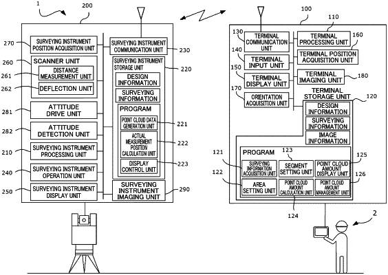
1. A surveying information management system for displaying surveying information by using an information display terminal and a surveying device configured to measure a point cloud in a three-dimensional space, the system comprising:
a surveying information acquisition unit configured to acquire, from the surveying device, the surveying information including point cloud data associated with position information;
an area setting unit configured to set a display area for the point cloud;
a segment setting unit configured to divide the display area into predetermined unit segments;
a point cloud amount calculation unit configured to calculate a point cloud amount in a space of each of the unit segments;
a point cloud amount display unit configured to display, on the information display terminal, information according to the point cloud amount calculated for each of the unit segments of the display area by the point cloud amount calculation unit; and
a terminal position acquisition unit capable of acquiring position information on the information display terminal, wherein
the point cloud amount display unit adjusts the position information acquired by the terminal position acquisition unit and local coordinates including the display area for the point cloud to each other so that a position of the information display terminal on the local coordinates can be displayed on the information display terminal.
|