| CPC B60W 40/09 (2013.01) [B60W 30/08 (2013.01); G06N 20/00 (2019.01); G06V 20/56 (2022.01); H04W 4/021 (2013.01); H04W 4/40 (2018.02)] | 17 Claims |

|
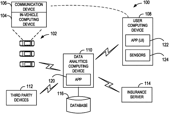
1. A data analytics computing device comprising at least one processor in communication with a memory device, the at least one processor programmed to:
receive geolocation data and telematics data associated with a first plurality of vehicles operated within a geographic area, the geolocation data captured at a location sensor of a vehicle computing device and representative of a location of the vehicle, the telematics data captured at a plurality of sensors of at least one of the vehicle or the vehicle computing device and representative of movement of the vehicle;
apply machine-learning techniques to the geolocation data and the telematics data to define standard driving behavior within the geographic area;
receive real-time telematics and geolocation data associated with a second plurality of vehicles operating in real-time within the geographic area;
detect, in the real-time telematics and geolocation data, a threshold deviation of real-time driving behavior from the standard behavior at a location within the geographic area;
based upon the detection, identify the location as experiencing non-standard driving behavior;
identify a plurality of alternate routes to avoid the identified location;
determine a respective alternate route of the plurality of alternate routes to which to send each respective vehicle currently within a threshold distance of the identified location, based upon one of: (i) output from a random number generator, or (ii) a determined current traffic capacity for each alternate route based upon the real-time telematics and geolocation data;
generate a set of instruction messages, each instruction message associated with a respective vehicle currently within the threshold distance of the identified location, each instruction message including an indicator of the identified location, a current location of the respective vehicle relative to the identified location, and respective instructions to re-route along the determined respective alternate route of the plurality of alternate routes; and
transmit each instruction message, each instruction message causing, at a respective recipient device, display of the instructions as an overlay on a real-time driving behavior map of the geographic area.
|