| CPC G08G 5/045 (2013.01) [G08G 5/0013 (2013.01); G08G 5/0043 (2013.01); G08G 5/065 (2013.01); H04W 4/42 (2018.02)] | 20 Claims |
|
1. A method of predicting vehicle collision zones, the method comprising:
enabling, by processing circuitry in response to a user input, a ground collision awareness system;
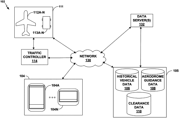
obtaining, by the processing circuitry of the ground collision awareness system, historical navigation route data for one or more reference vehicles, the historical navigation route data being based on transponder positional data;
identifying, by the processing circuitry, a plurality of aerodrome guidance features for a particular aerodrome location, the aerodrome guidance features including guidance marker information fixed to a surface of the particular aerodrome location;
determining, by the processing circuitry, a predicted path of a first vehicle, the predicted path comprising a first portion and a second portion, the first portion of the predicted path being predicted using the guidance marker information, and the second portion of the predicted path being predicted using the historical navigation route data;
determining, by the processing circuitry deploying a machine learning model trained on the historical navigation route data, a predicted position of the first vehicle along the predicted path at a prospective time;
determining, by the processing circuitry deploying the machine learning model trained on the historical navigation route data, a predicted position of a second vehicle with respect to approximately the same prospective time;
performing, by the processing circuitry, a comparison of a first vehicle envelope for the first vehicle and a second vehicle envelope for the second vehicle at the predicted positions;
identifying, by the processing circuitry, an overlap of the first vehicle envelope and the second vehicle envelope;
determining, by the processing circuitry, a predicted collision zone of the first vehicle and the second vehicle at the prospective time based at least in part on the overlap of the first vehicle envelope and the second vehicle envelope, and the aerodrome guidance features; and
outputting, to a display device, an alert that includes an indication of the predicted collision zone.
|