| CPC G08G 5/006 (2013.01) [B64C 39/024 (2013.01); G08G 5/0013 (2013.01); G08G 5/0039 (2013.01); G08G 5/0069 (2013.01); G08G 5/045 (2013.01); B64U 2101/30 (2023.01)] | 16 Claims |
|
1. A drone air traffic control method comprising:
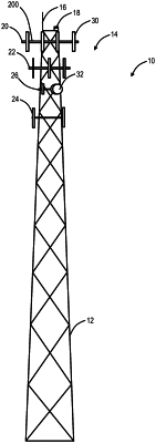
in an air traffic control system configured to manage Unmanned Aerial Vehicle (UAV) flight in a plurality of geographic regions, wherein the air traffic control system has one or more servers configured to (1) manage each geographic region which is predetermined based on a geographic boundary and subdivided into a plurality of waypoints and (2) maintain a database of the plurality of waypoints including a status of each of the plurality of waypoints, communicating to one or more UAVs via one or more wireless networks, wherein the one or more UAVs are configured to maintain their flight in the plurality of geographic regions based on coverage of or connectivity to the one or more wireless networks;
managing a plurality of flying lanes in each of the geographic regions, each of the plurality of flying lanes defining a predefined geographical path for drone flight, the predefined geographical path defined by waypoints of the plurality of waypoints;
obtaining data related to a UAV and at least one other UAV of the one or more UAVs, wherein the data includes flight operational data, flight plan data, cell signal strength data, and sensor data related to obstructions and other UAVs, wherein obstructions include other UAVs and static or dynamic objects at or near the ground, and wherein the obstructions and cell signal strength data used for a flight plan of the UAV are obtained from the flight operational data of the at least one other UAV, the flight plan including one or more flying lane assignments in geographic regions through which the UAV will travel;
scoring each of the one or more UAVs based on a reliability and accuracy of the obtained data;
analyzing and storing the data, based on the score given to the one or more UAVs, for each geographic region for updating the database of the plurality of waypoints, flight paths of the plurality of flying lanes, and updating the geographical path of flying lanes affected by the obstructions and cell signal strengths and of other flying lanes based on a status of the waypoints, wherein the status of the waypoints can be one of obstructed, clear, or unknown based on the obstructions, and wherein the analyzing includes determining the reliability and accuracy of the data based on crowd-sourcing the data for database updates; and
managing flight of the one or more UAVs in the geographic regions based on the status of the waypoints, wherein the one or more UAVs each include an antenna communicatively coupled to the one or more wireless networks to communicate therewith and monitor cell signal strength during the flight, and wherein the flight is constrained during the flight by providing the updated geographical path of an assigned flying lane to the one or more UAVs, adjusting flying lane assignments for the one or more UAVs, and continuing the flight based therein to constrain the one or more UAVs to operate only where coverage exists within each of the geographic regions.
|