| CPC G06T 19/006 (2013.01) [G06T 5/006 (2013.01); G06T 5/50 (2013.01); H04N 5/265 (2013.01); H04N 7/181 (2013.01); H04N 23/661 (2023.01); H04N 23/695 (2023.01); H04N 23/698 (2023.01); H04N 23/90 (2023.01); G06T 2207/10016 (2013.01); G06T 2207/20221 (2013.01)] | 12 Claims |
|
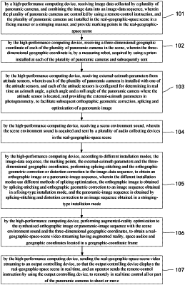
1. A method for constructing a real-geographic-space scene in real time based on a panoramic-video technique, wherein the method for constructing the real-geographic-space scene in real time comprises:
by a high-performance computing device, receiving image data collected by a plurality of panoramic cameras, and combining the image data into an image-data sequence, wherein the plurality of panoramic cameras are controlled by using a remote-control instruction, and the plurality of panoramic cameras are installed in the real-geographic-space scene in a fixing manner or a stringing manner, and provide marking points in the real-geographic-space scene;
by the high-performance computing device, receiving a three-dimensional geographic coordinate of each of the plurality of panoramic cameras in the scene, wherein the three-dimensional geographic coordinate is, by a measuring robot, acquired by using a prism installed at each of the plurality of panoramic cameras and subsequently sent;
by the high-performance computing device, receiving external-azimuth parameters from attitude sensors, wherein each of the plurality of panoramic cameras is installed with one of the attitude sensors, and each of the attitude sensors is configured for determining in real time an azimuth angle, a pitch angle and a roll angle of the panoramic camera where the attitude sensor is located, and providing the external-azimuth parameters in photogrammetry, to facilitate subsequent orthographic geometric correction, splicing and optimization of a panoramic image;
by the high-performance computing device, receiving a scene environment sound, wherein the scene environment sound is acquired and sent by a plurality of audio collecting devices in the real-geographic-space scene;
by the high-performance computing device, according to different installation modes, the image-data sequence, the marking points, the external-azimuth parameters and the three-dimensional geographic coordinates, performing splicing-stitching and the orthographic geometric correction or distortion correction to the image-data sequence, to obtain an orthographic image or a panoramic-image sequence, wherein the different installation modes use different methods of splicing optimization, the orthographic image is obtained by splicing-stitching and orthographic geometric correction to an image sequence obtained in a fixing-type installation mode, and the panoramic-image sequence is obtained by splicing-stitching and distortion correction to an image sequence obtained in a stringing-type installation mode;
by the high-performance computing device, performing augmented-reality optimization to the synthesized orthographic image or panoramic-image sequence with the scene environment sound and the three-dimensional geographic coordinates, to obtain a real-geographic-space-scene video streaming having augmented reality, space audios and geographic coordinates located in a geographic-coordinate frame; and
by the high-performance computing device, sending the real-geographic-space-scene video streaming to an output controlling device, so that the output controlling device displays the real-geographic-space scene in real time, and an operator sends the remote-control instruction by using the output controlling device, to remotely in real time control all or part of the panoramic cameras to shoot or move.
|