| CPC G06T 7/55 (2017.01) [G01C 5/005 (2013.01); G01C 21/04 (2013.01); G06T 7/30 (2017.01); G06T 7/70 (2017.01); H04N 23/90 (2023.01); G06T 2207/10032 (2013.01); G06T 2207/30244 (2013.01)] | 17 Claims |
|
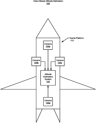
1. A computer program product including one or more non-transitory machine-readable mediums encoded with instructions that when executed by one or more processors cause a process to be carried out for altitude estimation of a platform, the process comprising:
generating a first projected ground image based on imagery provided by a first camera of the platform and based on a hypothesized altitude;
obtaining a first reference ground image based on navigation data associated with the platform;
registering the first projected ground image to the first reference ground image;
generating a second projected ground image based on an image provided by a second camera of the platform and based on the hypothesized altitude;
obtaining a second reference ground image based on navigation data associated with the platform;
performing a second registration to register the second projected ground image to the second reference ground image;
generating a match score associated with the first registration and the second registration; and
selecting the hypothesized altitude as the estimated altitude based on the match score.
|