| CPC G06F 3/04817 (2013.01) [G06F 3/04847 (2013.01); G06F 16/29 (2019.01); G06F 16/9537 (2019.01); G06T 11/206 (2013.01)] | 16 Claims |
|
1. A system comprising:
one or more processors; and
a memory storing instructions that, when executed by the one or more processors, cause the system to perform:
precomputing, by a computing device, geographical boundaries of a plurality of regions to be displayed through an interface as vectorized tiles, wherein each of the plurality of regions is associated with geospatial information comprising a plurality of objects;
caching, by the computing device, the vectorized tiles for the plurality of regions for reuse;
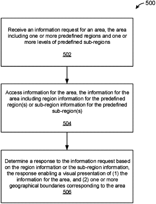
receiving, by the computing device, a first request specifying an area and a second request specifying information of the area;
displaying, by the computing device, a map of the area specified in the first request on the interface;
receiving, by the computing device, a selection of one or more selected regions of the plurality of regions on the map displayed on the interface;
obtaining, by the computing device, information of the one or more selected regions;
obtaining, by the computing device, based on non-geographical criteria, sub-regions within each of the one or more selected regions, the determination of the sub-regions comprising demarcating each of the sub-regions based on a type of contextual information;
determining visual augmentations within at least a portion of the sub-regions to be displayed on the interface based on the obtained information of the one or more selected regions and based on the non-geographical criteria, wherein the determining comprises:
determining a number of visual icons to be displayed on the interface based on a criterion that includes a restriction of a number of pixels used to display the map, wherein the visual icons represent a subset of the objects to be populated on the interface;
ranking the objects;
selectively displaying the visual icons according to rankings of the objects; and
displaying the visual icons at one or more different sizes based on the type of the contextual information; and
displaying the visual augmentations on the interface as a response to the first request and the second request.
|