| CPC G05D 1/0278 (2013.01) [G01S 19/485 (2020.05); G05D 1/0022 (2013.01); G05D 1/0038 (2013.01); G05D 1/0234 (2013.01); G06T 7/33 (2017.01); G06T 7/70 (2017.01); G06T 2207/10032 (2013.01); G06T 2207/30232 (2013.01)] | 18 Claims |
|
1. A method comprising:
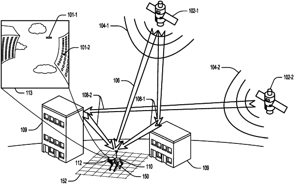
capturing sensor data using one or more machine sensors of a mobile machine, wherein capturing the sensor data includes:
capturing satellite data from one or more satellites; and
capturing an image using an imaging device that is at least partially oriented toward the one or more satellites;
calculating a set of sky scores for a set of ground positions surrounding the mobile machine based on the satellite data and the image, wherein each of the set of sky scores is indicative of an accuracy of a satellite-based position at one of the set of ground positions, and wherein at least one sky score of the set of sky scores is calculated by:
segmenting the image into a plurality of regions based on radio frequency (RF) characteristics of objects in the image, wherein the plurality of regions includes at least three regions corresponding to at least three different amounts of RF obstruction of the objects in the image;
projecting the one or more satellites onto the image; and
calculating the at least one sky score based on the projected one or more satellites; and
modifying a navigation of the mobile machine using the set of sky scores.
|