| CPC G01S 15/89 (2013.01) [G01S 7/52003 (2013.01); G01S 7/524 (2013.01); G01S 7/52047 (2013.01); G01S 7/53 (2013.01); G01S 13/862 (2013.01); G01S 15/42 (2013.01); G01S 15/8902 (2013.01); G01S 15/8925 (2013.01); G01S 15/8977 (2013.01); G01S 17/86 (2020.01); G10K 11/34 (2013.01)] | 17 Claims |
|
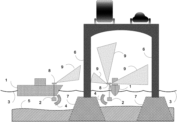
1. A method of real time three dimensional (3D) sonar imaging, comprising:
insonifying a volume of fluid with a series of sonar pings;
receiving for each of the series of sonar pings sonar signals reflected from a first set one or more objects in the volume of fluid, wherein the sonar signals are received with a multielement detector array of sonar signal detectors;
beamforming the detected sonar signals to provide a series of three-dimensional sonar images of the one or more objects in the first set, wherein the positions and the distances of the objects in the first set with respect to the multielement detector array of sonar signal detectors are imaged repeatedly at regular intervals;
measuring the position of the multielement detector array of sonar signal detectors with respect to a second set of one or more objects outside the fluid, wherein at least one of the objects inside the volume of fluid and at least one of the objects outside the fluid are fixed in relationship to one another, wherein the position of the multielement detector array of sonar signal detectors with respect to one or more objects outside the fluid is measured using electromagnetic radiation means repeatedly at regular intervals; and
providing a spatially corrected merged view or map representation of the three dimensional sonar images of the one or more objects in the first set using the position and orientation of the multielement detector array with respect to the second set to correct apparent position and/or orientation errors between frames for each ping in the series of sonar pings, and wherein the spatially corrected merged view or map representation is updated at regular intervals.
|