| CPC A01G 22/00 (2018.02) [A01G 7/00 (2013.01); A01G 25/00 (2013.01); G05B 19/042 (2013.01); G06Q 10/063 (2013.01); G06Q 50/02 (2013.01); G05B 2219/21109 (2013.01); G05B 2219/25032 (2013.01); G05B 2219/45017 (2013.01)] | 20 Claims |
|
1. A method comprising:
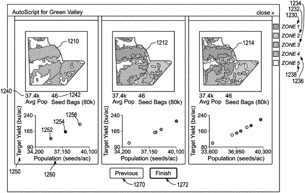
using instructions programmed in a computer system, determining a plurality of management zone delineation options, wherein each of the plurality of management zone delineation options has a different count of zones;
wherein determining the plurality of management zone delineation options includes determining a plurality of count values for a management class count and generating a management zone delineation option for each count value; and
wherein generating the management zone delineation option for each count value includes clustering yield data and field characteristics data for an agricultural field based on the count value;
selecting two or more options from the plurality of management zone delineation options, and determining one or more planting plans for each of the two or more options; and
using a presentation layer of the computer system, generating and causing displaying on a computing device a graphical representation of the two or more options of the plurality of management zone delineation options and a graphical representation of the one or more planting plans associated with each of the two or more options.
|