| CPC G08B 5/002 (2013.01) [A61B 5/746 (2013.01); A62B 33/00 (2013.01); B64C 39/024 (2013.01); B64U 2101/20 (2023.01)] | 15 Claims |
|
1. A system for rescue support, comprising:
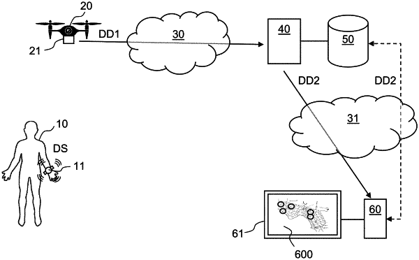
a fleet of unmanned aerial vehicles for deployment within a geographic region, the unmanned aerial vehicles being configured to receive distress signals transmitted by transponder devices worn or carried by individuals in the geographic region subsequent to a large-scale emergency situation, wherein the distress signals include physiological data from one or more sensors associated respective transponder devices,
wherein at least one unmanned aerial vehicle of the fleet of unmanned aerial vehicles includes one or more environmental sensors for generating environment data representative of surroundings of the at least one unmanned aerial vehicle, the environment data includes one or more images; and
a computer system configured to:
process the distress signals to obtain detection data for the individuals, the detection data comprising a location of a respective transponder device among the transponder devices and a health status of a respective individual among the individuals, wherein the health status is determined based on the physiological data,
process the one or more images to determine an infrastructure status within the geographic region, and
generate, based on the location, health status, and environment data, a prioritization chart for the geographic region, the prioritization chart being indicative of one or more sub-regions with associated priorities for a rescue operation,
wherein to generate the prioritization chart, the computer system is further configured to perform one or more of:
determine an estimated time of arrival to the one or more sub-regions for one or more rescue teams located at a respective current location in relation to the geographic region, and include the estimated time of arrival in the prioritization chart;
select one or more candidate rescue teams among a set of available rescue teams, and indicate the one or more candidate rescue teams in the prioritization chart;
select a mode of transport among a set of available modes of transport for at least one rescue team, and indicate the mode of transport in the prioritization chart; or
determine a transportation route for a rescue team to the one or more sub-regions, and indicate the transportation route in the prioritization chart.
|