| CPC G06F 16/26 (2019.01) [G06F 16/29 (2019.01); G06Q 10/06315 (2013.01)] | 14 Claims |
|
1. A system for generating service areas, the system comprising:
a database, wherein the database is configured to store location identifiers, wherein the location identifiers are associated with geographic regions and comprise structured geospatial information; and
a control circuit, wherein the control circuit is communicatively coupled to the database, and wherein the control circuit is configured to:
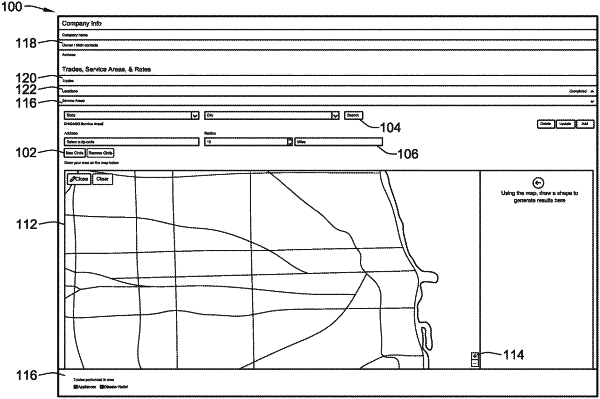
generate a user interface, wherein the user interface includes an interactive map;
receive, from a user, first user input representing unstructured geospatial information, wherein the first user input indicates boundaries drawn within the interactive map;
generate, based on the first user input, a boundary shape;
augment the interactive map to include the boundary shape;
convert, based on accessing the database, the unstructured geospatial information to the structured geospatial information to determine one or more location identifiers associated with the first user input, wherein the control circuit converts the unstructured geospatial information to the structured geospatial information in one of real time and near real time;
generate, based on the first user input and the one or more location identifiers, a location identifiers presentation, wherein the location identifiers presentation includes geographic regions associated with the one or more location identifiers;
augment the interactive map to include the location identifiers presentation; and
cause presentation, via a display device, of the interactive map including the boundary shape and the location identifiers presentation.
|