| CPC G01S 19/39 (2013.01) [B60R 1/00 (2013.01); B64C 39/024 (2013.01); B64D 47/08 (2013.01); G05D 1/0094 (2013.01); G06F 16/51 (2019.01); G06F 16/5838 (2019.01); G06F 16/5866 (2019.01); G06T 11/60 (2013.01); G06V 20/176 (2022.01); G08G 5/0039 (2013.01); G08G 5/0069 (2013.01); G08G 5/0086 (2013.01); G08G 5/045 (2013.01); H04N 21/4316 (2013.01); H04N 21/47 (2013.01); B60R 2300/8093 (2013.01); B64U 2101/30 (2023.01); B64U 2201/10 (2023.01); B64U 2201/20 (2023.01); G06Q 40/08 (2013.01)] | 23 Claims |
|
1. A computerized system, comprising:
a computer system having an input unit, a display unit, one or more processors, and one or more non-transitory computer readable medium, the one or more processors executing software to cause the one or more processors to:
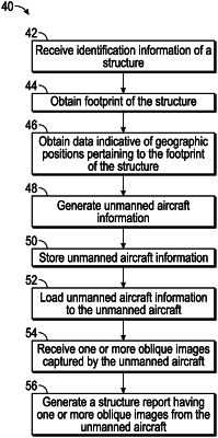
receive a geographic location, the geographic location having one or more coordinates of a structure having walls;
subsequent to receiving a validation of the geographic location of the structure, generate unmanned aircraft information based on the one or more coordinates of the validated location and a boundary of the structure, the unmanned aircraft information including an offset from the walls to direct an unmanned aircraft to fly an autonomous flight path offset from the walls, and camera control information to direct a camera of the unmanned aircraft to capture images of the walls at a predetermined time interval while the unmanned aircraft is flying the flight path, the predetermined time interval and the offset set so that the captured images overlap ensuring complete coverage of the walls;
receive the images of the walls captured by the camera while the unmanned aircraft is flying the autonomous flight path from the unmanned aircraft; and
generate a structure report for the structure having walls based at least in part on the images.
|