| CPC G01S 17/89 (2013.01) [G01S 5/02522 (2020.05); G01S 5/02525 (2020.05); G01S 7/4808 (2013.01); G01S 17/87 (2013.01); H04W 4/021 (2013.01); H04W 4/029 (2018.02); H04W 4/33 (2018.02); H04W 4/38 (2018.02)] | 11 Claims |
|
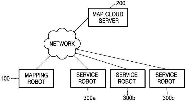
1. A location data collecting method using a mobile data collecting apparatus having a processor, a first sensor and a second sensor, the method comprising:
collecting space data for generating a location and moving path of the mobile data collecting apparatus and sensing location data indicating a sensing location of the mobile data collecting apparatus where the sensing location data is obtained respectively through the first sensor and the second sensor while the data collecting apparatus is currently moving within a target area, and tagging a first timestamp value and a second timestamp value respectively to the space data and the sensing location data;
generating temporary map data of the target area, and temporary location data at a point of time corresponding to the first timestamp value, based on the space data collected while the data collecting apparatus is currently moving;
calculating a similarity between pieces of the space data and a similarity between pieces of the sensing location data;
detecting a loop closure indicating the mobile data collecting apparatus has re-visited a location previously passed by the mobile data collecting apparatus, based on the similarity between the pieces of the space data and the similarity between the pieces of the sensing location data;
detecting a sensing error in the temporary map data by comparing the space data previously collected with space data collected at the re-visited location;
generating map information regarding a map of the target area by correcting the sensing error in the temporary map data, and generating moving path information regarding a moving path of the mobile data collecting apparatus on the map of the target area by correcting a sensing error in the temporary location data;
estimating a sensing location of the mobile data collecting apparatus at a point of time corresponding to the second timestamp value based on the moving path information generated after correcting the sensing error in the temporary location data, using the sensing location data previously collected while the temporary map data were being generated; and
storing sensing location data indicating the estimated sensing location of the mobile data collecting apparatus on the moving path information,
wherein the sensing location data indicating the estimated sensing location is used to identify a location of a mobile device moving within the map of the target area.
|