| CPC E02F 9/205 (2013.01) [E02F 9/262 (2013.01); E02F 9/265 (2013.01); G05D 1/027 (2013.01); G05D 1/0238 (2013.01); G05D 1/0278 (2013.01); G06T 7/521 (2017.01); G06T 7/70 (2017.01); G06T 17/05 (2013.01); G06V 10/764 (2022.01); G06V 20/58 (2022.01); G06V 20/64 (2022.01); G05D 2201/0202 (2013.01); G06T 2200/04 (2013.01); G06T 2207/10028 (2013.01); G06T 2207/30261 (2013.01); G06T 2210/56 (2013.01)] | 25 Claims |
|
1. A powered earth-moving vehicle having an on-board perception system, comprising:
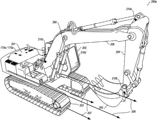
a chassis, one or more wheels or tracks, a first hydraulic arm that is rotatably coupled to the chassis at a first connection point, and a tool attachment coupled at a second connection point to the first hydraulic arm or to a second hydraulic arm that is coupled to the first hydraulic arm;
a plurality of GPS antennas mounted at a plurality of locations on the chassis and configured to repeatedly provide GPS coordinates that indicate absolute locations of at least some of the chassis and that are based at least in part on received GPS signals;
a lidar sensor mounted on a movable component of the powered earth-moving vehicle and being configured to repeatedly generate a plurality of three-dimensional (3D) data points for one or more areas of an environment of a job site surrounding the powered earth-moving vehicle, the component being one of the first hydraulic arm or the second hydraulic arm or the tool attachment, and the 3D data points having coordinates representing relative locations from a position of the lidar sensor; and
at least one low-voltage microcontroller having one or more hardware processors and one or more memories with software instructions that, when executed by the one or more hardware processors, perform automated operations including at least:
generating a 3D representation of the one or more areas of the environment by, for each of multiple time periods:
receiving some of the GPS coordinates that are generated for the time period, and some of the plurality of 3D data points that are generated for the time period for at least one of the one or more areas of the environment;
generating 3D point cloud data for the at least one area of the environment at the time period that includes the some 3D data points and represents a contour of one or more surfaces in the at least one area;
determining, based at least in part on one or more readings for the time period of one or more inclinometers, the position of the lidar sensor for the time period, wherein at least one of the inclinometers is mounted on the component, and wherein the one or more readings of the one or more inclinometers provide one or more angular positions relative to the chassis; and
compiling at least some of the 3D representation that corresponds to the at least the one area, including using the determined position of the lidar sensor for the time period to adjust the coordinates of the some 3D data points in the 3D point cloud data to reflect the absolute locations of the at least some chassis for the time period, and combining the some GPS coordinates for the time period with the some 3D data points for the time period using the adjusted coordinates;
and wherein the generating of the 3D representation further includes, during one or more of the multiple time periods, moving the component to cause the at least one area for which the some 3D data points are generated for that time period to be different from at least one other prior area before the moving;
classifying, for each of one or more solid objects identified in the one or more areas from the 3D representation, a type of obstacle of that solid object;
planning autonomous operations for the powered earth-moving vehicle in the one or more areas of the environment based at least in part on 3D data points in the 3D representation and the classified types of the one or more solid objects; and
implementing the autonomous operations of the powered earth-moving vehicle without receiving human operator input and without receiving external signals other than the received GPS signals or additional signals for use in correcting the received GPS signals.
|