| CPC G01S 19/47 (2013.01) [G01S 19/20 (2013.01); G01S 19/40 (2013.01); G01S 19/44 (2013.01)] | 23 Claims |
|
1. A method comprising:
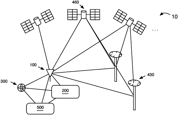
receiving a set of satellite observations associated with a plurality of satellites;
monitoring the set of satellite observations for one or more potential satellite faults;
receiving at least one of acceleration data, angular velocity data, or magnetic field data associated with an IMU sensor;
monitoring the at least one of acceleration data, the angular velocity data, or the magnetic field data for one or more potential IMU sensor faults;
determining a position estimate and associated positioning error for the rover based on the set of satellite observations and the at least one of the acceleration data, the angular velocity data, or the magnetic field data;
determining a protection level associated with the position estimate based on a set of potential faults, an impact of each fault of the set of faults, a probability of each fault of the set of faults occurring, and a probability of not detecting each fault of the set of faults, wherein the determined protection level exceeds a true protection level by at most 10%; and
providing an alert when the positioning error exceeds the protection level.
|