| CPC G06T 7/90 (2017.01) [G06T 7/74 (2017.01); G06T 2207/10024 (2013.01); G06T 2207/20021 (2013.01)] | 20 Claims |
|
1. A method for generating an overhead view image of a geographical area, the method comprising;
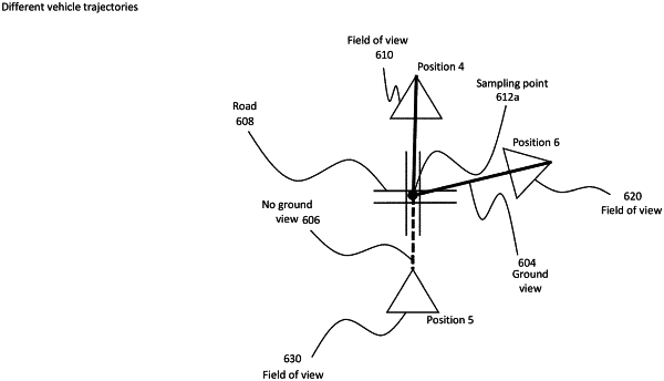
receiving a plurality of images of the geographical area that are captured over trajectories through the geographical area at ground level;
determining a ground map of the geographical area;
dividing the ground map into a plurality of sampling points of the geographical area; and
determining a color for each of the plurality of sampling points by determining a correlation between the sampling points of the geographical area and a color of the sampling points captured in at least one of the plurality of images, including determining a camera view ray in relation to each of the sampling points and the plurality of images to identify corresponding pixels between the plurality of images and the sampling points, wherein the plurality of images are collected over separate trajectories of different vehicles through the geographical area.
|