| CPC G06Q 40/08 (2013.01) [G06Q 30/0278 (2013.01); G06V 20/176 (2022.01)] | 20 Claims |
|
1. A computer-implemented method, comprising:
retrieving, via a computer network, an aerial image corresponding to a geographic location associated with a structure;
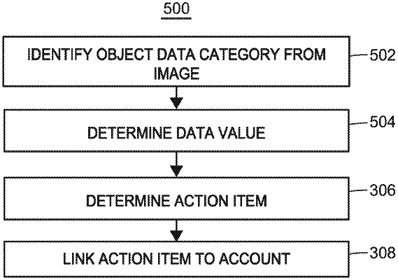
analyzing, at the one or more processors, the aerial image to identify a first object within the aerial image, wherein identifying the first object includes (i) identifying a first object data category corresponding to the first object, and (ii) determining objective and subjective data values descriptive of the first object and corresponding to the first object data category;
identifying, at the one or more processors, one or more action items based upon the first object data category and the objective and subjective data values;
linking, at the one or more processors, the one or more action items to a customer account that is associated with the geographic location; and
performing, at the one or more processors, one or more actions corresponding to the one or more action items.
|