| CPC G01C 15/02 (2013.01) [G01C 11/02 (2013.01); B64C 39/024 (2013.01); B64U 2101/30 (2023.01)] | 20 Claims |
|
1. A system, comprising:
a processor; and
a memory storing instructions that when executed by the processor, cause the processor to:
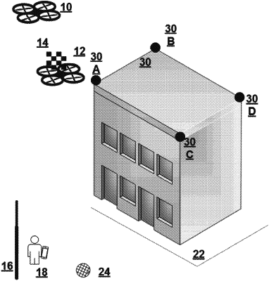
receive location information identifying one or more locations associated with a first unmanned vehicle being navigated within a first area during a first time period;
receive one or more images of the first area including the first unmanned vehicle and one or more landmarks, wherein the one or more images are captured by a second unmanned vehicle when the second unmanned vehicle is flying at a higher altitude than the first unmanned vehicle; and
correlate a first captured image of the one or more images that includes the first unmanned vehicle and a first landmark of the one or more landmarks with first location information of the one or more locations based on a timestamp associated with the first captured image and a timestamp associated with the first location information.
|