| CPC G05D 1/028 (2013.01) [G01C 21/3815 (2020.08); G01C 21/3848 (2020.08); G01C 21/3852 (2020.08); G01S 17/89 (2013.01); G05D 1/0094 (2013.01); G05D 1/024 (2013.01); G05D 1/0274 (2013.01); G06F 18/251 (2023.01); G06V 10/56 (2022.01); G06V 20/13 (2022.01); G06V 20/58 (2022.01); G08G 1/012 (2013.01); G08G 1/0125 (2013.01); H04W 4/024 (2018.02); G01S 19/14 (2013.01); G01S 19/47 (2013.01); G05D 2201/0213 (2013.01); G08G 1/161 (2013.01); G08G 1/166 (2013.01); H04W 4/46 (2018.02)] | 23 Claims |

|
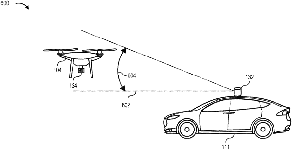
1. A system for sharing sensor information between multiple vehicles, comprising:
an aerial vehicle including a first computing device;
a first scanning sensor coupled to the aerial vehicle;
a ground vehicle including a second computing device;
a second scanning sensor coupled to the ground vehicle;
the first computing device including at least one processor and a scanning manager, the scanning manager including first instructions which, when executed by the processor, cause the scanning manager to:
obtain first scanning data from the first scanning sensor; and
transmit the first scanning data to the second computing device; and
the second computing device including at least one processor and a detection manager, the detection manager including second instructions which, when executed by the processor, cause the detection manager to:
receive the first scanning data from the first computing device;
obtain second scanning data from the second scanning sensor;
identify an overlapping portion of the first scanning data and the second scanning data based on at least one reference object in the first scanning data and the second scanning data;
calibrate the second scanning data to obtain calibrated second scanning data based on the first scanning data and the overlapping portion to reduce transformation distortion; and
execute a navigation control command based on one or more roadway objects identified in the calibrated second scanning data.
|