| CPC G08G 1/162 (2013.01) [G01C 21/3461 (2013.01); G01C 21/3811 (2020.08); G06V 20/58 (2022.01); G08G 1/052 (2013.01); G08G 1/056 (2013.01); G08G 1/096716 (2013.01); G06V 2201/08 (2022.01)] | 19 Claims |
|
1. An information processing device comprising:
a storage unit that stores map information, wherein the map information includes road map information of an area;
a communication unit connected to a network and configured to communicate the map information to a plurality of vehicles via the network; and
a control unit including a processor that is programmed to:
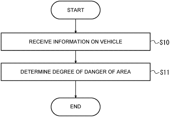
receive information on at least one vehicle traveling in the area which is received by the communication unit, wherein the information on the at least one vehicle includes information on a steering angle of a wheel of the vehicle, and wherein the at least one vehicle is among the plurality of vehicles;
determine a degree of danger of the area based on the information on the vehicle, wherein
when an amount of change in the steering angle of the wheel per unit time is larger than a reference amount set in advance, determine a higher degree of danger as the degree of danger of the area compared with a case where the amount of change is equal to or smaller than the reference amount;
update the map information in the storage unit to specify the area is a dangerous area according to the degree of danger of the area; and
communicate the updated map information to the plurality of vehicles via the network.
|