| CPC G06T 11/206 (2013.01) [A01M 1/026 (2013.01); G06F 3/04842 (2013.01); G06N 20/00 (2019.01); G06T 7/0002 (2013.01); G06T 11/001 (2013.01); G06T 11/203 (2013.01); G06T 2200/24 (2013.01); G06T 2207/10032 (2013.01); G06T 2207/20081 (2013.01); G06T 2207/30188 (2013.01)] | 20 Claims |
|
1. A heat map generation computing device comprising:
a memory; and
a processor communicatively coupled to the memory, the processor programmed to:
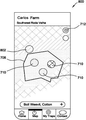
receive trap data for a plurality of pest traps in a geographic location, the trap data including current and historical pest pressure values at each of the plurality of pest traps;
receive at least one of i) weather data for the geographic location and ii) image data for the geographic location;
apply a machine learning algorithm to the trap data and the at least one of the weather data and the image data to generate predicted future pest pressure values at each of the plurality of pest traps;
generate a first heat map for a first point in time and a second heat map for a second point in time, the second heat map generated using the predicted future pest pressure values, the first and second heat maps each generated by:
plotting a plurality of nodes on a map of the geographic location, each node corresponding to one of the plurality of pest traps, each node indicating the pest pressure value for the corresponding pest trap at the associated point in time; and
annotating at least some remaining portions of the map of the geographic location to generate a continuous map of pest pressure values for the geographic location by interpolating between pest pressure values associated with the plurality of nodes at the associated point in time; and
transmit the first and second heat maps to a mobile computing device to cause a user interface on the mobile computing device to display a time lapse heat map that dynamically transitions between the first heat map and the second heat map over time, the user interface implemented via an application installed on the mobile computing device.
|