| CPC G01V 1/301 (2013.01) [G01V 1/282 (2013.01); G01V 1/366 (2013.01); G01V 1/38 (2013.01); G01V 2210/64 (2013.01); G01V 2210/6652 (2013.01)] | 21 Claims |

|
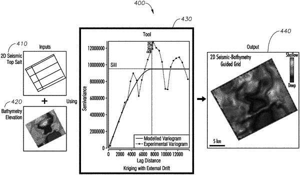
1. A method for gridding of subsurface salt structures, the method comprising:
determining a predetermined area that lacks three-dimensional seismic coverage;
generating a two-dimensional map of seismic top salt interpretation for the predetermined area based on data received from a two-dimensional reflection seismic survey performed by moving both sound sources and sound detectors along a straight line;
generating a map of bathymetry elevation of the predetermined area;
determining that at least one two dimensional seismic line intersects a bathymetric feature of interest;
and determining a correlation coefficient between the two dimensional seismic top salt interpretation and the bathymetry elevation by cross-plotting the two dimensional seismic top salt interpretation and the bathymetry elevation.
|