| CPC G05D 1/0094 (2013.01) [B64C 39/024 (2013.01); B64D 31/06 (2013.01); B64D 47/08 (2013.01); G05B 13/0265 (2013.01); G05B 17/02 (2013.01); G05D 1/0088 (2013.01); G05D 1/101 (2013.01); G06T 7/55 (2017.01); G06T 7/74 (2017.01); G06T 17/00 (2013.01); G06T 19/20 (2013.01); G06V 20/13 (2022.01); G06V 20/64 (2022.01); H04N 23/64 (2023.01); H04N 23/695 (2023.01); H04N 23/90 (2023.01); B64U 10/13 (2023.01); B64U 2101/30 (2023.01); G06T 2207/10032 (2013.01); G06T 2207/20221 (2013.01); G06T 2219/2004 (2013.01)] | 20 Claims |
|
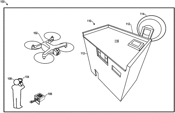
1. An unmanned aerial vehicle (UAV) comprising:
one or more image sensors;
a propulsion mechanism; and
one or more processors configured by executable instructions to perform operations comprising:
receiving, by the one or more processors, from a computing device, an indication of a scan target;
controlling, by the one or more processors, the propulsion mechanism of the UAV to cause the UAV to assume a plurality of positions for directing a field of view of the one or more image sensors based on the indication of the scan target;
capturing, using the one or more image sensors, a plurality of images from different respective positions of the plurality of positions;
determining a three-dimensional (3D) model based on distances to one or more surfaces of the scan target determined based on the plurality of images, the 3D model including a plurality of points corresponding to one or more surfaces of the scan target;
accessing the 3D model including the plurality of points;
determining, based on the 3D model, a scan plan for scanning at least a portion of the scan target, the scan plan including a plurality of poses for the UAV to assume to capture, using one or more image sensors, images of the scan target, wherein a respective pose of the scan plan is determined based on a respective point of the 3D model;
capturing, with the one or more image sensors, while the UAV is in flight, one or more images of the scan target from one or more poses of the plurality of poses;
determining, while the UAV is in flight, an update to the 3D model based at least in part on the one or more images; and
based at least in part on the update to the 3D model, updating the scan plan while the UAV is in flight.
|