| CPC G06T 7/0004 (2013.01) [G06F 18/24 (2023.01); G06T 7/60 (2013.01); G06T 7/62 (2017.01); G06T 15/005 (2013.01); G06V 10/42 (2022.01); G06V 10/44 (2022.01); G06T 2200/04 (2013.01); G06T 2207/10032 (2013.01); G06T 2207/30108 (2013.01)] | 19 Claims |
|
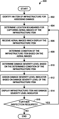
1. A method for surveying a property using an unmanned aerial vehicle (UAV), the method comprising:
identifying, by one or more processors on a computing device, a commercial property for the UAV to perform surveillance;
directing, by the one or more processors, the UAV to hover over the commercial property and capture, via an imaging device, aerial images at predetermined time intervals;
receiving, by the one or more processors, the aerial images of the commercial property captured at the predetermined time intervals;
determining, by the one or more processors, a damage severity level for the commercial property based on the aerial images;
generating, by the one or more processors, a surveillance alert;
transmitting, by the one or more processors, the surveillance alert to an electronic device associated with an authorized user associated with the commercial property; and
upon receiving and authenticating user login information to confirm that a user of the electronic device is the authorized user associated with the commercial property, transmitting, by the one or more processors, a property display web page to the electronic device, the property display web page including a damage severity level indicator displayed overlaying the aerial images of the commercial property.
|