| CPC G06F 16/2365 (2019.01) [G06F 3/0482 (2013.01); G06F 3/0484 (2013.01); G06F 16/29 (2019.01); G06F 16/56 (2019.01); G06F 40/186 (2020.01); G06Q 50/26 (2013.01); H04W 4/021 (2013.01)] | 18 Claims |
|
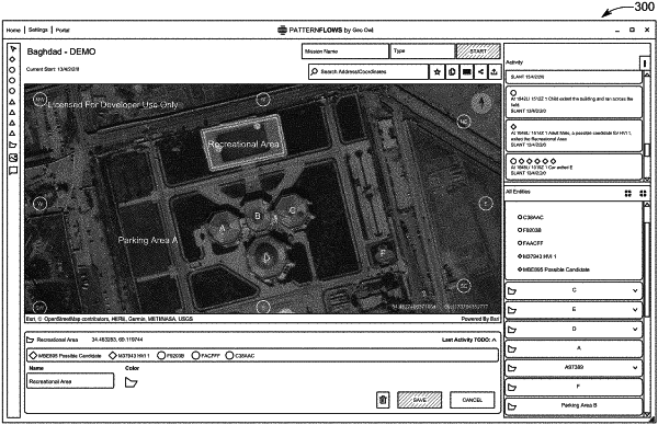
1. A method implemented on at least one server for facilitating one or more users in determining and logging intelligence, surveillance, and reconnaissance (ISR) information, the method comprising:
receiving georeferenced map data;
receiving image data;
transmitting the georeferenced map data and image data to a client device;
receiving ISR data from the client device; and
storing the ISR data, wherein:
the ISR data comprises map call-out data including georeferenced data and slant count formatted data;
at least a portion of the map call-out data is entered from a graphical user interface (GUI) on the client device;
the georeferenced data is associated with a geometrical shape and the geometrical shape is entered from a wheel based menu on the GUI;
the geometrical shape is represented in the map call-out data as a series of geographic coordinates;
the slant count formatted data comprises a first numerical indication of one or more persons of interest, and a second numerical indication of one or more vehicles of interest; and
the GUI is configured to display the slant count formatted data.
|