| CPC G01S 7/4817 (2013.01) [G01S 7/4863 (2013.01); G01S 17/89 (2013.01)] | 15 Claims |
|
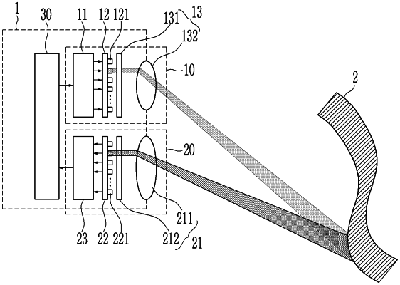
1. A Laser Imaging, Detection, and Ranging (LIDAR) system, wherein the LIDAR system comprises:
a light transmitting unit configured to include a plurality of light emitting elements and drive the plurality of light emitting elements by light emitting units to irradiate light to different positions of a target object; and
a light receiving unit configured to include a plurality of light detector cells and detect, through the plurality of light detector cells, light that is reflected at different positions of the target object and that then is incident to different light receiving positions through a plurality of light receiving regions,
wherein when misalignment occurs in the LIDAR system, distortion information corresponding to the misalignment is corrected with respect to data obtained by the detected light based on misalignment correction data, and
wherein when misalignment occurs by at least one of the light emitting elements of the light transmitting unit and the light detector cells of the light receiving unit and distortion of data is generated thereby, distortion information corresponding to the misalignment is corrected with respect to the data obtained by the detected light in real time based on the misalignment correction data obtained through a separate process.
|