| CPC G01C 21/3667 (2013.01) [G01C 21/3484 (2013.01); G01C 21/3697 (2013.01); H04W 4/024 (2018.02); G06Q 40/08 (2013.01)] | 27 Claims |
|
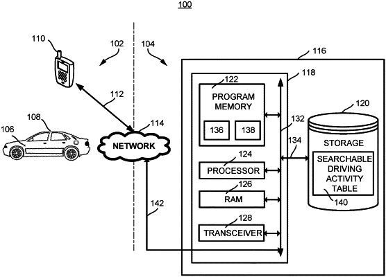
1. A computer-implemented method for generating neighborhood maps, the method comprising:
receiving, by a server, geolocation data and auxiliary data associated with a user's driving activities;
aggregating, by the server, the geolocation data and the auxiliary data;
identifying, by the server, based upon the aggregated geolocation data and auxiliary data, a plurality of driving routes;
determining, by the server, from the identified plurality of driving routes and based upon a travel frequency threshold, one or more designated driving routes frequently traversed by the user;
generating, by the server, a user neighborhood map that includes the one or more designated driving routes; and
transmitting, by the server, the user neighborhood map to the user.
|