| CPC G01C 21/3461 (2013.01) [G01C 21/3638 (2013.01); G06N 20/00 (2019.01); G06T 17/05 (2013.01); G08G 1/202 (2013.01)] | 20 Claims |
|
1. A computer-implemented method comprising:
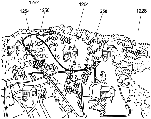
receiving a plurality of images captured by an image sensor disposed on an imaging vehicle, the plurality of images representing a physical region including a ground surface of the physical region;
determining damage to an object represented in one or more images of the plurality of images;
determining a damage location associated with the object on the ground surface of the physical region;
determining a target location on the ground surface of the physical region;
generating a ground-based route from a current location of a response vehicle on the ground surface of the physical region, to the target location, wherein the ground-based route is based at least in part on the damage location;
generating a virtual model of the physical region based at least in part on the plurality of images, the virtual model including a graphical representation of the ground-based route along the ground surface of the physical region, the current location, and the target location; and
providing the virtual model to a rendering device via a network.
|