| CPC G01C 21/206 (2013.01) [A61B 1/000094 (2022.02); G01C 21/3848 (2020.08); G06T 7/579 (2017.01); G06T 7/73 (2017.01); G06V 10/44 (2022.01); G06V 10/757 (2022.01); G06V 20/56 (2022.01); G01C 21/16 (2013.01)] | 20 Claims |
|
1. A method for simultaneous localization and mapping (SLAM), comprising:
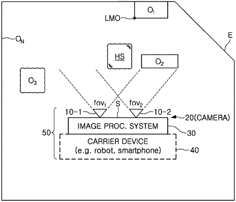
receiving, from first and second image sensors, first and second event streams, respectively, each comprising a plurality of event packets indicating events corresponding to points of surfaces in an environment, wherein a number of events is controlled in event frame units and each event frame is formed by movement of the first and second image sensors;
computing depths of the points represented by the first event stream based on relative pixel locations of common points represented by the second event stream; and
updating a map of the environment, based at least on the points represented by the first event stream and the computed depths thereof, wherein the events are triggered when a log intensity of a pixel changes by more than a threshold,
wherein each of the event packets of the events comprises a time stamp representing a time of the pixel intensity change, a pixel address within a pixel grid of the first or second image sensor, and a polarity bit indicating whether the pixel intensity change was positive or negative.
|