| CPC G06Q 10/06313 (2013.01) [G06T 11/206 (2013.01)] | 20 Claims |
|
1. A method, comprising:
displaying, by a computer using a graphical user interface, a map of a geographical area, wherein the map includes political boundaries;
displaying, by the computer, graphical images on the map representing a plurality of aspects associated with management of a plurality of projects as corresponding geographical features on the map;
graphically segregating, by the computer, the plurality of projects on the map using the political boundaries;
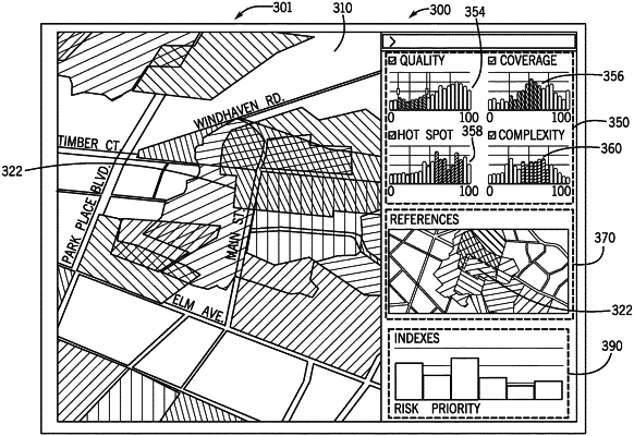
displaying, by the computer, different layers that overlap the map of the geographic area to represent different test results for a software product including one or more test results of quality, coverage, priority, or complexity;
receiving input, via interaction with the displayed map; and
changing, by the computer, in response to the interaction with the displayed map, how a given aspect of the plurality of aspects of a given project of the plurality of projects is represented on the map.
|