| CPC G06V 20/588 (2022.01) [G06N 3/045 (2023.01); G06T 7/285 (2017.01); G06T 7/73 (2017.01); G06V 20/582 (2022.01); G06V 20/647 (2022.01); G06T 2207/10021 (2013.01); G06T 2207/10028 (2013.01); G06T 2207/20081 (2013.01); G06T 2207/20084 (2013.01); G06T 2207/30256 (2013.01)] | 11 Claims |
|
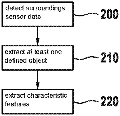
1. A method for providing data for creating a digital map, comprising the following steps:
obtaining surroundings sensor data captured in an overlapping manner during a measuring run of a physical system, the surroundings sensor data including:
first surroundings sensor data, which represents surroundings of the physical system as a first three-dimensional, cloud of points; and
second surroundings sensor data, which represents the surroundings of the physical system as a two-dimensional arrangement of pixels;
registering the first surroundings sensor data to the second surroundings sensor data so that each of the points of the cloud of the first surroundings sensor data is associated with a respective one of the pixels;
using a first neural network:
processing the first surroundings sensor data to identify a subset of the pixels of the second surroundings sensor data corresponding to a predefined object; and
based on the registration, selecting a subset of the points of the cloud of the first surroundings sensor data corresponding to the subset of the pixels, the selected subset of the points forming a three-dimensional representation of the predefined object;
extracting, using a second neural network:
a subset of the subset of the points corresponding to one or more characteristic features of the predefined object; and
descriptors of the one or more characteristic features;
based on the descriptors, aligning the subset of the subset of the points with a subset of another subset of points, which is of a second in three-dimensional cloud of points; and
based on the alignment of the subset of the subset of the points with the subset of the another subset of points, stitching the first and second three-dimensional clouds of points to each other, thereby creating at least a part of a three-dimensional map.
|