| CPC G01C 21/3863 (2020.08) [G01C 21/3811 (2020.08); G01C 21/3815 (2020.08); G01C 21/3833 (2020.08); G01C 21/3848 (2020.08); G01C 21/387 (2020.08)] | 17 Claims |

|
1. A method for updating a map of a surrounding area of a transportation vehicle, wherein the map is used in control of navigation of the transportation vehicle, the method comprising:
evaluating the map of the surrounding area as part of vehicle navigation;
controlling differentiated operation of sensors on the transportation vehicle based on whether the evaluation of the map of the surrounding area indicates a presence of a landmark being recorded in the map of the surrounding area, wherein the differentiated operation controls the sensors to perform sensor-based landmark detection only in response to the presence of the landmark being indicated in the map of the surrounding area;
in response to the sensors of the transportation vehicle being controlled to perform sensor-based landmark detection and unsuccessfully detecting a landmark indicated in the map of the surrounding area, developing a deletion hypothesis by the transportation vehicle to propose deletion of the indicated landmark presence in the map of the surrounding area;
transmitting the developed deletion hypothesis to an external central computer;
verifying the developed deletion hypothesis in the external central computer;
deleting the indication of the presence of the landmark from the map of the surrounding area in accordance with the deletion hypothesis in response to the verification of the deletion hypothesis; and
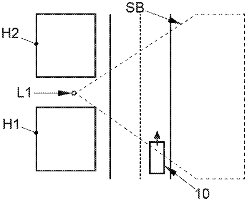
updating the map of the surrounding area to generate an updated map by recording visibility range information for the indication of the landmark presence in the map of the surrounding area, the visibility range information indicating a range within which the landmark is visible from a road,
wherein, thereafter, the visibility range information for the indication of the landmark presence is evaluated during subsequent evaluation of the updated map of the surrounding area to control whether sensor-based landmark detection should be performed as part of vehicle navigation at a determined location of the transportation vehicle in the updated map.
|