| CPC G06T 7/001 (2013.01) [B64C 39/024 (2013.01); G06T 7/73 (2017.01); G06V 10/761 (2022.01); G06V 20/17 (2022.01); G06V 20/176 (2022.01); B64U 2101/30 (2023.01); B64U 2201/10 (2023.01); G06T 2207/10032 (2013.01); G06T 2207/20081 (2013.01); G06T 2207/30184 (2013.01)] | 4 Claims |
|
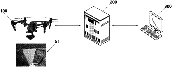
1. A method for an image analysis server to detect a change to a structure by using a drone, the method comprising:
receiving a first image of the structure taken at a first time and a second image of the structure taken at a second time by a drone;
acquiring a first feature map for the first image and a second feature map for the second image using a machine learning algorithm;
detecting a difference between a first feature of the first feature map and a second feature of the second feature map;
predicting a risk of the structure based on the detected difference using a recurrent neural network; and
measuring an area of an actual structure in which the change is detected based on the first feature map and the second feature map,
wherein detecting the difference comprises,
determining a relative size of the area of the structure in which the change is detected in the second feature map with a same angle view of the first feature map with respect to a total area of the structure in the first feature map, and
determining a risk level of the structure by comparing the area of the structure where the change is detected with a preset value,
wherein measuring the area of the actual structure comprises,
calculating a ratio between a first distance between feature points in the second feature map of the structure and a second distance between feature points in the actual structure, and
calculating the area of the actual structure by applying the ratio to a change region within the second feature map of the structure,
wherein the recurrent neural network comprises a long short-term memory algorithm generating a new image capable of predicting the change of the structure over time.
|